Honeymoon at Santorini
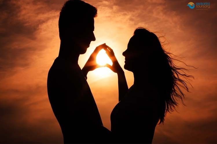
If you are a couple who seeks romantic moments for your honeymoon at Santorini, if you want to experience the most precious time of your life away from the noisy mob of tourists, at a warm atmosphere of a calm and picturesque island, then Santorini is one of the best choices for your honeymoon.
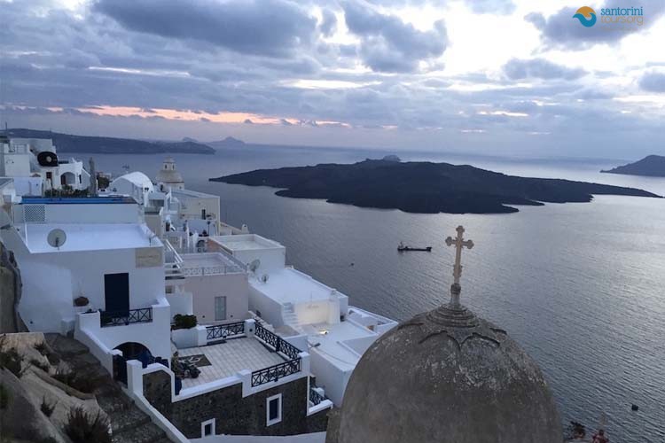
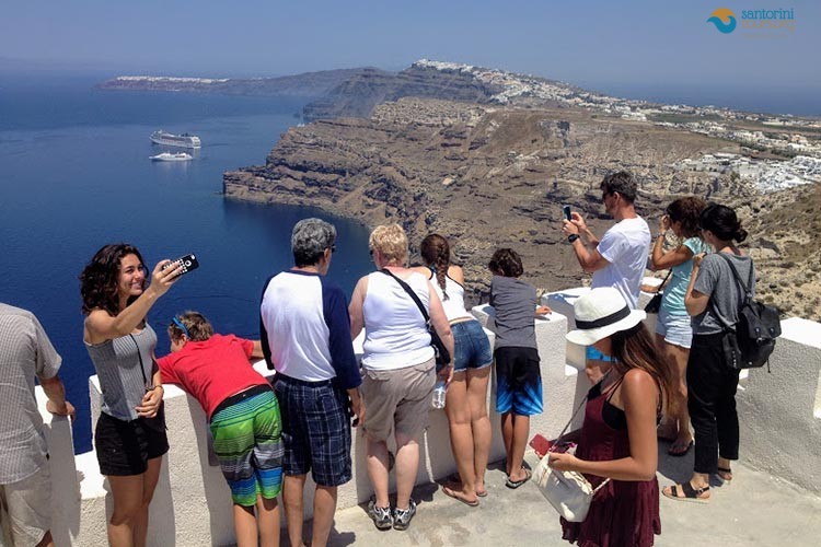
In Santorini you can view amazing sceneries with small villages and tens of churches with light blue domes, as well as you can enjoy the fresh air and the magic beaches with dark rounded stones and white or red sand, you can even try the marvelous local cuisine along with high quality services. There are many who claim that the sunset view is the best thing to see in the island and many couples from around the world visit Santorini for that reason.
Things to do during your honeymoon at Santorini
There are a lot of things to see and thing to do in Santorini island that is will be difficult to decide what your activities will be. In order to help you to organize the perfect honeymoon vacations we made a list with proposals:
Following the above guided tours you are going to have the most romantic experience in your lifetime and an unforgettable honeymoon!
Accommodation
You can find high quality hotels at Santorini, rooms to rent and luxurious wedding suites for very low prices. For an unforgettable honeymoon in Santorini, you can choose throughout a wide variety of hotels with romantic atmosphere and view to the volcano.
How to reach Santorini
The fastest way to reach the island of Santorini is by plane. Another way to visit the island is of course by ship. Santorini can be reached by ships from the ports of Peirea and Rafina, as well as from the neighbouring islands of Kuklades, such as, Ios, Mukonos, Amorgos, Paros, Naxos and others. Santorini is a destination for ships from Crete and Rodos island and basically from all the islands of Dodekanisa complex and the islands of eastern Aigean with in between stops.
The trip can be done with the standard ferry-boat, with high-speed ferries or with flying dolphin, depending on the day and the company that you choose. If you choose a simple ferry-boat it takes approximately 5 – 7.30 hours whereas if you choose high-speed ferries then duration is 3.40 – 5.30 hours. That sure depends on how many islands will the ship aproach to stop. The ship routes Peireas – Santorini are daily through the year and during summer they are doubled or more due to increased tourist activity.
What a Honeymoon at Santorini Is Really Like
Half the hotels on this island exist for honeymooners, and the island earns that. It also has no beaches worth the name, two hundred steps between most rim rooms and the nearest road, and forty-degree afternoons in August. A honeymoon at Santorini is one of the best short trips in Europe when it is planned around those facts, and an expensive disappointment when it is not.
What you are actually coming for. A flooded volcanic crater eleven kilometres across with a three-hundred-metre cliff around it and white villages along the top. Nowhere else looks like this, and a honeymoon at Santorini is worth it for the caldera alone.
How long to stay. Three or four nights. Two is a transit stop and ten is too long without pairing the island with another one.
The honest warning about beaches. Black volcanic sand, organised strips, and nothing at all on the caldera side. If sand matters to your honeymoon at Santorini, add Naxos or Paros for the second half.
The honest warning about steps. The rim villages are staircases. Couples book a cliff suite and discover two hundred steps between the road and the room, with luggage.
The honest warning about crowds. Oia at sunset in August is thousands of people on one street. Every romantic photograph you have seen was taken at six in the morning.
What makes it work anyway. The early hours, the inland half of the island, and sunsets somewhere other than Oia. Those three decisions transform a honeymoon at Santorini more than any hotel upgrade.
Who it suits best. Couples who want scenery, wine, archaeology and long dinners, and who are content to be up at seven twice.
Who should think again. Anybody whose picture of a honeymoon at Santorini is a beach and a lounger for a week. That holiday exists in Greece, but not here.
The romantic part that is genuinely true. Terraces cut into a cliff, dinner with the whole caldera below you, and an island small enough that nothing is more than forty minutes away.
The part nobody mentions. It is a working island of fifteen and a half thousand people carrying two million visitors a year, and the infrastructure shows it. Planning around that is the whole job.
What this page covers. When to come, where to sleep, what to do, what it costs, how to get here, and what to skip. Everything below is what we tell couples who ask us to build a honeymoon at Santorini from scratch.
When to Come
The month decides more about a honeymoon at Santorini than the hotel does. The same suite, the same view and the same restaurant produce a completely different week in May and in August.
May, the gentlest month for a honeymoon at Santorini. Green, cool, everything open and the crowd not yet arrived. The island at its most forgiving and one of the two best months for a honeymoon at Santorini.
June. Long days, warm sea from the middle of the month, manageable heat. The most popular honeymoon month and still comfortable.
July. Hot, busy and windy. The meltemi starts cancelling boats, which matters if a caldera cruise is on your list.
August. Peak heat, peak crowds, peak prices, and the hardest month here by a distance. A honeymoon at Santorini in August works, but everything has to move to seven in the morning and after six in the evening.
September, the best month for a honeymoon at Santorini. The best month on the island by most local measures. Warm sea, lighter crowds, the grape harvest finishing, and evenings you can sit outside in.
October and the honeymoon at Santorini. Quiet, beautiful, cheaper, with shorter days and the first rain. Excellent for a honeymoon at Santorini if you do not need to swim every day.
November to March. Most of the rim closes, the boats stop and the island belongs to the fifteen thousand people who live here. Storm light over the caldera, very low prices, and half the restaurants shut.
April. Reopening month and variable. Wild flowers, cool sea, and some sites still on winter hours.
Easter. Orthodox Easter is the busiest Greek domestic weekend of the year. Spectacular to witness and a poor week to expect quiet.
The sea temperature point. The Aegean is cold until June and warmest in September. Couples planning a honeymoon at Santorini around swimming should come later rather than earlier.
The sunset point. Sunset moves by nearly two hours between June and December, which changes when dinner happens and how long the evening is.
The cruise calendar. Calls concentrate from May to October. Three or four ships in one day puts thousands of extra people into Fira and Oia between ten and four, and the schedule is published in advance.
What a honeymoon at Santorini costs by season. A rim suite in August can be three times the same room in May. This is the single largest cost lever on a honeymoon at Santorini.
What we would choose. Late May, mid-June, or the first three weeks of September. Same island, a third of the people, and evenings that are actually pleasant.
Where to Stay
This is the decision that makes or breaks a honeymoon at Santorini, and it is almost always made on a photograph rather than on a map. The rim is spectacular and it is stairs, no parking and triple the price.
The caldera rim on a honeymoon at Santorini. Oia, Imerovigli, Firostefani and Fira. Cave suites cut into the cliff, private plunge pools, and the view that sold you the trip.
What the rim costs you besides money. No road access to most properties, luggage carried down by porter, and a long climb every time you leave. Worth it for two or three nights of a honeymoon at Santorini, tiring for seven.
Oia for a honeymoon at Santorini. The most beautiful and the most crowded. Quiet from nine in the evening and empty before eight in the morning, and a scrum in between.
Imerovigli. The highest point of the rim, quieter than Oia, with the walk out to Skaros on your doorstep. Our usual first suggestion for a honeymoon at Santorini.
Firostefani, the calm choice for a honeymoon at Santorini. Ten minutes’ walk from Fira with the classic view back over it, and noticeably calmer.
Fira. Central, convenient, noisy at night and full of cruise passengers by day. Good for a first visit, less good for a honeymoon.
Inland: Pyrgos, Megalochori, Emporio, Karterados. Level ground, village prices, real tavernas and the caldera twenty minutes away. This is where the honeymoon at Santorini that people rave about six months later usually happened.
The beaches: Kamari, Perissa, Perivolos. Black sand, organised, flat, and far cheaper. Sensible for longer stays and for anybody who wants to swim daily.
Vlychada. Quiet south coast under carved white cliffs, with a marina and almost no crowd.
The split stay. Two nights on the rim and two inland or at a beach. The best structure for a honeymoon at Santorini and the one we suggest most often.
What to check before booking. How many steps from the road, whether luggage is carried, whether the pool is shared, and whether the terrace is overlooked by the walkway above.
The overlooked terrace problem. Many cliff suites sit directly below a public path. Ask for a photograph taken from above, not from the terrace.
Cave rooms on a honeymoon at Santorini. Cool, dark, carved into pumice, and often without a window. Some couples love them and some find them oppressive.
The booking window for a honeymoon at Santorini. The good rim rooms for June to September go six months out. Everything else is easier.
What we would do. Imerovigli or Firostefani for the view nights, Megalochori or Kamari for the rest, and a car or a driver rather than a rim postcode.
The Days: What to Actually Do
Four days is the right length. This is the shape we build for couples, and it keeps the crowded hours for things that do not mind a crowd.
Day one, morning: Oia at seven. Empty lanes, the blue domes, the castle ruin, the light on the cliff. Every couple who does this says afterwards it was the best hour of the honeymoon at Santorini.
Day one, late morning: Amoudi. Two hundred and eighty steps down to the fishing harbour, tavernas on the water and a swim off the rocks at the chapel. Go down early or not at all.
Day one, midday: the Fira museums. The Museum of Prehistoric Thera and the Archaeological Museum, both air-conditioned, ten minutes apart.
Day one, evening: Imerovigli and Skaros. Twenty-five minutes out along the ridge to the chapel, and the best free view on the island.
Day two of the honeymoon at Santorini: the caldera by boat. Nea Kameni’s crater, the hot springs swim, Thirasia for lunch, and the cliff from below in the evening light. The most memorable single day of most honeymoons here.
Day three, morning: Akrotiri. A Bronze Age town buried in 1600 BC with its streets and three-storey houses intact, roofed and cool. Ninety minutes, and a genuine surprise on a honeymoon at Santorini.
Day three, afternoon: a winery. Basket vines, a cellar cut into pumice, Assyrtiko and Vinsanto, with somebody else driving.
Day three, evening: Pyrgos. The old capital, a spiral of lanes to a Venetian kastelli, and both coasts at once at sunset.
Day four: the south. The Akrotiri lighthouse, the Red Beach viewpoint, Vlychada under its carved cliffs, and Emporio’s kastelli.
The beach afternoon of a honeymoon at Santorini. Kamari or Perivolos, black sand, organised and easy, for the day the honeymoon at Santorini needs to stop moving.
The walk every honeymoon at Santorini should include. Fira to Oia along the rim, ten kilometres, three to four hours, started at six thirty. No shade and no water, and one of the best coastal walks in Greece.
Dinner on a honeymoon at Santorini. One rim dinner with the view, and the rest in villages. A rim table costs three to four times a village one for food that is often worse.
The spa afternoon. Most rim hotels have one, and it is the right use of two in the afternoon in August.
What to leave out. Ancient Thera unless archaeology interests you, and the Oia sunset scrum if the trip is short.
The pace. Four stops a day, not eight. A honeymoon at Santorini that is run like a coach tour is the commonest self-inflicted mistake we see.
The Sunset, Handled Properly
The sunset is the reason a great many couples come, and Oia is the worst place to watch it. Getting this right is the highest-value hour of a honeymoon at Santorini.
What actually happens in Oia. In July and August, several thousand people on one narrow street and the castle steps, arriving from about an hour before, with no parking and a slow crawl out afterwards.
Imerovigli, our sunset answer for a honeymoon at Santorini. The cliff, the light on Skaros, and a fraction of the crowd. Ten minutes from Fira on foot.
The Akrotiri lighthouse. The southwestern tip, built in 1892, with space, parking and the same sun. The quietest good sunset on the island.
Pyrgos. Inland and high, with the whole island and both coasts below. Almost nobody is there at any hour.
Profitis Ilias. The monastery at five hundred and sixty-seven metres, the highest point, with Ios and Anafi on a clear horizon.
Sunset from the water on a honeymoon at Santorini. A sunset catamaran or a private boat, with the cliff going gold from below. The most photographed version of a honeymoon at Santorini for good reason.
Firostefani. The wide terrace with Fira spilling down the rim, five minutes’ walk from the centre and considerably calmer.
Your own terrace, the honeymoon at Santorini you paid for. If you have booked a west-facing rim suite, use it rather than walking to Oia.
The Oia compromise. If you want Oia specifically, book a restaurant table with a view two to three weeks ahead and be seated before seven. That is the only comfortable way to do it in season.
The other Oia compromise. Go at sunrise instead. Same village, same light on the other side, and nobody there.
Sunset timing on a honeymoon at Santorini. Sunset moves nearly two hours between June and December. Check the actual time for your dates rather than assuming eight o’clock.
The photograph. The blue domes face west and photograph best in early morning light, not at sunset. This surprises most couples planning a honeymoon at Santorini around evening pictures.
Getting away afterwards. Oia’s approach road is closed by the police when the car parks fill, and the queue out lasts well past dark.
What we suggest. One sunset from the water, one from Imerovigli or the lighthouse, and one from your own terrace with a bottle of Assyrtiko. That covers the honeymoon at Santorini everybody actually wanted.
Wine, Food and Long Dinners
The island’s cooking and its wine grew up together on volcanic ash without irrigation, and eating properly is one of the most reliable pleasures of a honeymoon at Santorini.
Assyrtiko, the bottle for a honeymoon at Santorini. Bone dry, high acid, saline and mineral, from ungrafted vines that predate phylloxera. It is the bottle to start with and it ages for a decade.
Vinsanto. Grapes sun-dried on mats for a fortnight, then years in barrel. Dark, sweet, with the acidity still underneath. The right end to a long dinner.
Nykteri. The old style of white, picked at night and fermented in wood, rounder than a modern Assyrtiko.
The basket vines. Woven into nests on the ground so the fruit sits inside, sheltered from the wind and gathering the night dew. They exist nowhere else and seeing them is worth an hour of any honeymoon at Santorini.
The estates worth a honeymoon at Santorini afternoon. Eight or so take visitors, most of them around Pyrgos, Megalochori and Episkopi. Two in an afternoon is right; four is drinking.
The one practical problem. Somebody has to drive, and Greek limits are strict on narrow unlit roads. This is the whole case for a driver on a wine afternoon.
The cherry tomato. Small, dense and intensely sweet, grown without irrigation and carrying protected origin status.
Fava. Not a broad bean. Santorini fava is a legume grown almost nowhere else, cooked to a warm purée with raw onion and oil.
White aubergine, capers and caper leaves. The rest of the island’s short list, all of it grown on ash without water.
Tomatokeftedes. Tomato fritters, which exist because the tomato is too small to slice and too good to waste.
Chloro cheese. Fresh, soft, sharp goat cheese made in small quantities and worth ordering wherever you see it.
Where to eat on a honeymoon at Santorini. Villages, not the rim. A rim table costs three to four times a village one and the view is doing most of the work.
The one rim dinner. Have it, once, booked in advance, and treat it as the splurge of the honeymoon at Santorini rather than the default.
Amoudi. Fish on the water below Oia, with the climb back up afterwards. Go early and take the road down if you can.
A cooking class on a honeymoon at Santorini. Two or three hours, and the fastest way to understand why these ingredients are cooked the way they are.
Breakfast. Most rim hotels serve it on the terrace. It is the single most underrated hour of a honeymoon at Santorini and nobody else is awake.
The Caldera by Boat
The one day almost every couple remembers. From the water the cliff is three hundred metres of layered ash above you instead of a terrace beneath your feet, and a honeymoon at Santorini without a boat day has missed the island’s best angle.
Nea Kameni, the volcano day of a honeymoon at Santorini. The black lava island in the middle of the caldera, built by eruptions between 1707 and 1950, still the active vent.
The crater walk. Thirty minutes on loose red gravel to a rim at about a hundred and thirty metres, with steam coming out of the ground and the smell of sulphur. Closed shoes, not sandals.
The park fee. Nea Kameni is a national geological park with its own entrance charge, paid on the island and on top of the boat ticket.
Palea Kameni and the hot springs. A shallow ochre bay where iron-rich water reaches the low thirties. You swim to it from the boat; it does not dock.
The swimwear warning. The iron stains light fabric permanently. Do not wear the white bikini bought for the honeymoon at Santorini into the springs.
Thirasia. The piece of the old island that broke away, one village on a cliff, under three hundred residents, and lunch at a pace Santorini itself lost fifty years ago.
The half-day version. Volcano, springs and back. Efficient, crowded and the most heavily sold.
The full-day boat, the better honeymoon at Santorini version. Volcano, springs, Thirasia, and Oia from the water in the evening light.
The sunset catamaran. Swim stops at the Red and White beaches, food aboard, and the cliff going gold. Rated almost entirely on how full the boat is, so ask the passenger number.
The private charter. Your own route and nobody else aboard. The most expensive day of most honeymoons here and frequently the best.
The wind that reshapes a honeymoon at Santorini. The meltemi cancels boats without notice, hardest in July and August. Book the boat early in the trip so a later day can absorb it.
What to bring. Two litres of water, a hat, closed shoes and no expectations of shade anywhere on the lava.
Where boats leave from. The old port below Fira, Ammoudi below Oia, and Vlychada on the south coast. Which one matters for your pickup time.
The small-boat point. A ninety-person catamaran and a twelve-person boat are different holidays. For a honeymoon at Santorini the smaller one is almost always worth the difference.
Why the Island Looks Like This
The view that sold you the trip is the inside wall of a volcano. Knowing the story makes a honeymoon at Santorini considerably more interesting than knowing only that the sunset is famous.
The caldera a honeymoon at Santorini is built around. A flooded crater roughly eleven kilometres across, up to three hundred and ninety metres deep, with a rim standing three hundred metres above the water on the western side.
The eruption. Around 1600 BC, one of the largest of the last ten thousand years emptied the magma chamber and dropped the centre of the island into the sea.
The cliff face. Those white and pink layers are the ash and pumice from that eruption, and geologists read them the way other people read a calendar.
Akrotiri, the surprise of a honeymoon at Santorini. A Bronze Age town buried by it, dug out with streets, drains and three-storey houses intact. No human remains and very little gold, which means the people left before it happened.
The frescoes. Blue monkeys, antelopes, a fleet of ships, boys boxing. Reproductions on the island, originals in Athens, and the single most surprising hour of most honeymoons here.
Nea and Palea Kameni. The black lava islands in the middle, still the active vent, built up by eruptions between 197 BC and 1950.
Thirasia and Aspronisi. The other surviving fragments of the pre-eruption island, which is why the whole thing reads as a ring on a map.
Mesa Vouno and Profitis Ilias. Limestone, marine sediment two hundred million years old, and older than the volcano underneath everything else.
The 1956 earthquake behind the honeymoon at Santorini view. Magnitude 7.5 on 9 July, which destroyed much of Oia and emptied the island of half its people. Most of what reads as charmingly ruined today dates from that morning.
Why there is no water. No rivers, no springs, porous ash. Everything is desalinated, and it is why the tomatoes, the fava and the wine taste the way they do.
Why the vines grow in baskets. Wind and dew. The nest shelters the fruit from the meltemi and collects the night moisture.
The Atlantis question. The eruption is the most popular candidate for the story Plato told. Unprovable, endlessly argued, and a good dinner conversation on a honeymoon at Santorini.
Why it matters to your trip. Every part of this island that looks romantic is a consequence of a catastrophe, and that is a better thing to know on the terrace than not.
Photographs Worth Having
Almost every couple wants pictures and almost every couple tries to take them at the wrong hour. Photography on a honeymoon at Santorini is a timetable rather than a location problem.
The blue domes every honeymoon at Santorini wants. On the lane below Oia’s main street. They face west, so they photograph properly in early morning light and badly at sunset, which is when everyone queues for them.
Oia at six thirty in the morning. Empty lanes, low warm light and no one in the frame. This is where the photographs you have seen come from.
Firostefani terrace. The classic wide shot of Fira spilling down the rim, best in the first two hours of the day.
Skaros Rock. The ridge walk from Imerovigli, with the chapel at the end and the whole caldera behind. Late afternoon.
The Three Bells of Fira. The blue-domed church on the path below town, which everybody recognises and few can name.
From the water on a honeymoon at Santorini. The cliff going gold from below, which is the one angle a honeymoon at Santorini cannot get from land.
Pyrgos rooftops. Inland, high, and nobody else there at any hour.
The vineyards. Basket vines on black ash, which look like nothing else and photograph best in flat morning light.
The Akrotiri lighthouse. Space to set up, parking, and a clean horizon.
Vlychada. Wind-carved white cliffs that read as a desert canyon rather than an Aegean beach.
A professional shoot. Widely available here, almost always at sunrise, and worth booking before you arrive if it matters to you.
Drones on a honeymoon at Santorini. Restricted around the airport and over archaeological sites, and the rules are enforced. Check before packing one.
What to wear. Something that moves in the wind. The meltemi is constant and it is the reason half the honeymoon at Santorini photographs on the internet look the way they do.
The practical note. Shoes again. The good spots involve steps, cobbles and loose ash, none of which is kind to what people plan to be photographed in.
Getting Here by Air
The fastest way to the island is a plane, and the arrival is the hour where a honeymoon at Santorini most often starts badly.
The airport a honeymoon at Santorini arrives into. Thira national airport sits on the east side of the island near Kamari, about fifteen minutes from Fira and twenty-five from Oia.
From Athens. Roughly forty-five minutes in the air, with several flights a day year-round and many more in summer.
Direct from Europe. Seasonal direct flights run from a long list of European cities between roughly April and October. Outside that window almost everything routes through Athens.
The connection trap. Athens domestic and international terminals are close, but a ninety-minute connection in August is optimistic. Give a honeymoon at Santorini a three-hour buffer rather than a tight one.
Baggage. Domestic Greek allowances are tighter than long-haul ones, and honeymoon luggage is rarely light. Check the number before you pack.
The terminal itself. Small, and completely overwhelmed at peak times. Arrivals can take forty minutes to reach the door in August.
Taxis at the airport. About thirty taxis serve the entire island. Assuming one will be waiting is the single most common arrival mistake on a honeymoon at Santorini.
The airport bus and the honeymoon at Santorini. Runs to Fira and is cheap, with no luggage space to speak of and a change for anywhere else.
The sensible answer. A transfer booked in advance, with a name board and a driver who knows where your hotel’s road access actually is.
The rim hotel problem. Most cliff properties have no vehicle access. The driver stops at the nearest road and a porter takes the luggage down the steps, and nobody tells couples this beforehand.
Departure day of a honeymoon at Santorini. Leave two and a half hours for a domestic flight in season and three for an international one. The airport queue is outdoors and there is no shade.
Flight cancellations. Strong meltemi occasionally diverts or cancels. Build a night in Athens into the end of the trip if the onward connection is critical.
What we do. Meet you inside the terminal, carry the bags, and get you to the right door. Arrival and departure are the two worst hours of a honeymoon at Santorini, and both are fixed in advance and cheaply.
Getting Here by Sea
Arriving by ship is the better entrance, because you come into the caldera and see the cliff before you see anything else. It is also slower and less reliable, and a honeymoon at Santorini that starts with a seven-hour ferry needs planning.
From Piraeus to a honeymoon at Santorini. The main route, daily through the year and several times a day in summer.
From Rafina. The other Athens port, closer to the airport and used by some fast ferries.
Conventional ferry. Roughly five to seven and a half hours from Piraeus depending on how many islands the ship calls at.
High-speed ferry. Roughly three and a half to five and a half hours, again depending on stops. Considerably more expensive and more weather-sensitive.
From the other Cyclades. Ios, Mykonos, Naxos, Paros and Amorgos all connect, most of them in one to two hours by fast boat. This is what makes a two-island honeymoon at Santorini easy.
From Crete. Heraklion connects in about two hours by fast ferry in season.
From the Dodecanese. Rhodes and the eastern Aegean islands connect with intermediate stops, on longer and less frequent routes.
The port a honeymoon at Santorini lands at. Athinios, cut into the cliff on the west coast with a single hairpin road up. There is no shade, no signage and very little space.
What arrival at Athinios is like. Six ferries unloading at once into sixty drivers holding name boards. It is the most stressful twenty minutes of most trips and the worst possible start to a honeymoon at Santorini.
The bus from the port. Runs to Fira, fills instantly, and has no luggage space.
The taxi from the port. Thirty vehicles for the island, all of them elsewhere when a ferry lands.
Seasickness. The Aegean in a strong meltemi is genuinely rough, and high-speed ferries are worse than conventional ones for it.
Cancellations. Wind stops sailings, sometimes at short notice. Never make a ferry the last leg before a flight home.
Booking the crossings for a honeymoon at Santorini. Summer sailings sell out, and vehicles more so. Book the crossings before the hotels if the dates are fixed.
What we suggest. Fly in and ferry out to a second island, or ferry in and fly home. Either way, have somebody meet you at Athinios with your name on a board so the honeymoon at Santorini starts in a car rather than in a queue.
Getting Around Once You Are Here
The island is seventy-six square kilometres and nothing is more than forty minutes from anything else. Moving around it is still the part couples underestimate on a honeymoon at Santorini.
The taxi fleet a honeymoon at Santorini relies on. About thirty vehicles for the whole island. This single number explains most transport problems here.
The bus. Cheap, functional, and everything routes through Fira. Two villages four kilometres apart can take an hour and two buses.
Hiring a car for a honeymoon at Santorini. Practical, and parking is the catch. Oia fills by nine thirty in season and Fira never works.
The licence point. Non-EU licences generally require an International Driving Permit in Greece, and rental firms do check.
ATVs and scooters. Everywhere, and responsible for a steady stream of holiday injuries on gravel and loose ash. Not the way to spend a honeymoon at Santorini.
A private driver on a honeymoon at Santorini. What it buys is hours rather than luxury: the early start, the parking that does not exist, and the ability to drink at a winery.
The cable car. Fira to the old port, three minutes, running early morning to late evening in season. The queue is the problem, up to two hours downhill on a heavy cruise day.
The old port steps. Six hundred of them, shared with mules, unpleasant in both directions.
The donkeys. Still offered and still not recommended, by us or by the welfare inspectors.
Walking the rim. Fira to Oia is ten kilometres along the cliff, three to four hours, no shade and no water. Beautiful at six thirty and punishing at eleven.
Walking within villages. Cobbles, steps and no level route. Pack shoes you can actually walk in, whatever the honeymoon at Santorini photographs suggested.
Road conditions. Narrow, unlit at night, and busy. The drive between Oia and Fira is twenty minutes and feels longer.
Timing around the ships. Cruise passengers land from about ten and leave from about four, concentrated in Fira and Oia. Be elsewhere.
The practical answer. A transfer for arrival and departure, a driver for the two full days, and your feet for everything else. That is how most of the honeymoons we handle are built.
What It Costs
Santorini is the most expensive island in Greece and the spread is enormous. The cost of a honeymoon at Santorini is decided by two choices: the month, and whether you sleep on the rim.
The rim premium on a honeymoon at Santorini. A caldera-view cave suite can be three to four times an equivalent inland or beach room, for the view and for nothing else.
The August premium. The same rim room in August can be three times its May price. Season is the single largest lever there is.
The combination. A rim suite in August against an inland room in May is close to an order of magnitude. Most sticker shock about a honeymoon at Santorini comes from comparing those two extremes.
Dinner on the rim. Three to four times a village taverna, for food that is frequently worse. The view is the product.
Dinner in a village. Pyrgos, Megalochori, Emporio, Karterados. Excellent, generous and a fraction of the price.
Wine. Expensive by mainland Greek standards, because yields here are tiny and everything is hand-harvested. Cellar door is cheaper than any shop.
Site entry. Akrotiri, Ancient Thera and the two Fira museums are all modest, and a combined ticket covers all four for less than two separate entries.
The boat. A shared volcano and springs trip is inexpensive. A small-group or private charter is the day most couples spend real money on, and rarely regret.
Transfers, the best value on a honeymoon at Santorini. Fixed and cheap relative to everything else, and the highest-value spend of the whole trip, because it removes the two worst hours.
A private driver for a day. Costs several times a bus day and buys back three or four hours plus every parking problem.
The hidden costs of a honeymoon at Santorini. The volcano park fee, the cable car, tastings and site tickets are commonly excluded from advertised tour prices. Ask, every time.
Where to save without noticing. Sleep inland, eat in villages, shop at a supermarket for breakfast, and keep one rim dinner as the occasion.
Where not to save. The arrival transfer, the boat, and the month. Those three decide how the honeymoon at Santorini actually feels.
The honest summary. This island can be done at almost any budget. What it cannot be done at is a mid-range budget spent entirely on the caldera rim in August.
Pairing It With a Second Island
Santorini is seventy-six square kilometres and it does not carry a fortnight on its own. The best long trips put three or four nights of a honeymoon at Santorini against a very different island for the rest.
Naxos, the usual partner to a honeymoon at Santorini. Bigger, greener, cheaper, with genuinely good beaches, mountain villages and a working town. About two hours by fast ferry and the most common pairing we suggest.
Paros. The balanced choice: real beaches, a proper town in Naoussa, good food and fewer crowds. Around two hours away.
Milos after a honeymoon at Santorini. The most extraordinary coastline in the Cyclades and a fraction of the visitors. Volcanic like Santorini but with the swimming this island lacks.
Ios. Half an hour by fast ferry, younger, cheaper and with better sand. Worth a night for the beaches rather than the nightlife.
Folegandros. A small cliff-top chora with almost no tourism, and the quietest counterweight to a honeymoon at Santorini there is.
Amorgos. For walkers, with the cliff monastery and very few other people.
Crete. Two hours by fast ferry to Heraklion, and effectively a country rather than an island. Mountains, gorges, cities and weeks of material.
Syros. A working nineteenth-century town with an opera house and no tourism at all. The opposite trip entirely.
Mykonos. Better beaches, more expensive, and a completely different evening. Two and a half hours away.
The order that works. Santorini first while you are fresh and prepared to get up at seven, then somewhere flat to stop moving. Doing a honeymoon at Santorini second, after a week of lying down, rarely goes well.
The ferry warning for a honeymoon at Santorini. Wind cancels sailings. Never put a crossing on the day of your flight home.
Booking. Summer fast-ferry sailings sell out. Fix the crossings before the hotels if your dates are set.
The simplest version. Fly into Santorini, four nights here, ferry to Naxos or Paros, and fly home from there or back through Athens.
The Mistakes Couples Make
These repeat every season, and every one of them is avoidable before you leave home. Most complaints about a honeymoon at Santorini are complaints about one of the following.
Booking the rim without counting the steps. Two hundred steps between the road and the room, with luggage, twice a day, in thirty-five degrees.
Coming in August. Peak heat, peak crowds, peak prices. May, June, September and October are better in every measurable way.
Expecting a beach holiday. Black sand, organised strips, nothing on the caldera side. A honeymoon at Santorini is not a beach honeymoon.
Staying seven nights. Three or four is right. Pair the rest with Naxos or Paros rather than stretching the island.
Doing the Oia sunset because it is famous. Two hours for twenty minutes of sun, shared with thousands, and a slow crawl out.
Sleeping through the mornings. Seven to nine is when the island is empty, cool and beautiful. Couples who never see it have missed the best of the honeymoon at Santorini.
Never leaving the rim. The inland villages are consistently what guests talk about afterwards and most visitors never go.
Not booking the transfer. Thirty taxis, a hairpin port road and no shade. This is the commonest ruined first hour.
Booking a ferry as the last leg home. Wind cancels sailings and flights do not wait.
Hiring a scooter or ATV. Loose ash, gravel and narrow roads. A steady supply of honeymoon injuries comes from exactly this.
Driving after a tasting. Strict limits, unlit roads, and no taxi coming.
Eating on the rim every night. Three to four times the price for worse food. One rim dinner, the rest in villages.
Packing the wrong shoes. Cobbles, steps, lava gravel and vineyard ash. The honeymoon at Santorini photographs are misleading about footwear.
Putting the boat on the last day. The meltemi cancels without notice and there is then no room to reschedule.
Over-scheduling. Eight stops a day is a coach tour. Four is a honeymoon.
Booking a cave room sight unseen. Cool and atmospheric, and often windowless. Ask for photographs of the actual room.
Not checking the cruise calendar. Three or four ships puts thousands of extra people exactly where you were going, between ten and four, and it is published in advance.
Practical Detail
The unglamorous things that decide how a week actually goes. None of this appears in a brochure and all of it matters on a honeymoon at Santorini.
Water. There are no rivers and no springs. Everything is desalinated, the tap water is not for drinking, and bottled water is universal.
Heat on a honeymoon at Santorini. Forty degrees is normal in August with no shade outdoors anywhere. Two litres per person per day, and nothing exposed between twelve and four.
Sun. The light here is fierce and reflects off white walls. Couples burn on day one and spend the rest of the honeymoon at Santorini regretting it.
Wind. The meltemi blows hardest in July and August. It makes the heat bearable and it cancels boats.
Plumbing. Paper goes in the bin, not the bowl, across most of the island. The pipes are narrow and it is not negotiable.
Power and plugs. Standard European two-pin, 230 volts.
Phone coverage. Good across the island. Get a number that answers for whoever is driving you.
Cash. Cards are accepted almost everywhere, though small village tavernas and the odd beach kantina prefer cash.
Pharmacies. Fira has several and they are excellent. They sell more rehydration salts than aspirin, which tells you something.
Medical. There is a health centre in Fira. Anything serious goes to Athens or Crete by air, so travel insurance is not optional.
Accessibility on a honeymoon at Santorini. Akrotiri is step-free inside its shelter. The rim villages, Skaros, Amoudi and the old port are not, with no alternative routes.
Earthquakes and the honeymoon at Santorini. The 2025 seismic swarm between Santorini and Amorgos ended that spring and activity returned to normal background levels. Monitoring here is now among the densest in Europe.
Dress codes. Monasteries and churches require modest dress. Profitis Ilias closes on some feast days.
Site closing days. The two Fira museums close on different days and Ancient Thera closes more often than either. Check the week you travel.
Greek holidays. 1 January, 25 March, Orthodox Easter Sunday, 1 May and 25 December close most sites.
Tipping. Not obligatory. Rounding up, or ten per cent for something genuinely good, is normal.
What to pack. Shoes you can walk on cobbles in, a hat, high-factor sun cream, a light layer for the evening wind, and swimwear you do not mind staining in the hot springs. That list covers most of the honeymoon at Santorini.
Honeymoon at Santorini: The Questions We Are Asked
How many nights should we stay? Three or four. Two is a transit stop and seven is too long without a second island.
When is the best month? Late May, mid-June or the first three weeks of September. Same island, a third of the people.
Is a honeymoon at Santorini worth it? For the caldera, the wine and the archaeology, yes, without qualification. For a beach week, no.
Should we stay in Oia? For one or two nights if the budget allows. Imerovigli and Firostefani give a similar view with far fewer people.
Rim or inland? Both, split. Two nights on the cliff and two on level ground is the structure that works best.
Are there really that many steps? Yes. Most rim properties have no road access and luggage is carried down by hand.
Can we swim? Yes, at Kamari, Perissa, Perivolos, Vlychada and Amoudi. Not from the caldera rim, which is a cliff.
Is the sea warm? Cold until June, warmest in September.
Do we need a car? Not strictly, but the bus routes everything through Fira and costs you the early hours, which are the best part of a honeymoon at Santorini.
Where should we watch the sunset? Imerovigli, the Akrotiri lighthouse, Pyrgos, or from a boat. Oia only if you have a booked table.
Is it safe after the earthquakes? Yes. The 2025 swarm ended in the spring and activity returned to normal background levels.
Can we get married here? Yes, and it is a separate process with its own paperwork. This page is about the honeymoon rather than the wedding.
What is the one thing you would change about most plans? The start time. Seven in the morning changes everything.
Is August impossible? No, but it is the hardest month and everything has to move earlier and later.
How much should we budget? Enormously variable. A rim suite in August against an inland room in May is close to ten times the difference.
What surprises couples most? The inland villages, and how good Akrotiri is.
Should we add another island? If you have more than five nights, yes. Naxos or Paros for the beach half.
What should we book before arriving? The transfers, the boat, the rim dinner, and a winery in high season. A honeymoon at Santorini needs very little else fixed in advance.
Planning Yours With Us
We live here and drive couples around this island for a living. What we sell is hours and information rather than romance, because the romance is already on the cliff and does not need our help.
Arrival and departure. Met at the airport or at Athinios with your name on a board, luggage carried, and taken to the right door rather than the nearest road. The worst two hours of a honeymoon at Santorini, removed.
The full-day private tour. Caldera villages, an archaeological site, a winery and a sunset point, at your pace, rebuilt on the day around the ship schedule and the wind.
The half-day south. Akrotiri, the lighthouse, the coloured beaches and a winery. Shaded or coastal throughout, which is why it is the right choice in high summer.
The wine afternoon. Two or three estates, the basket vines and the cellars, with neither of you having to stay sober.
The sunset run. Imerovigli, Pyrgos or the lighthouse, with somewhere to park and no crawl home afterwards.
The boat day. Booked early in your stay so the weather has somewhere to go, on a small boat rather than a large one.
The early morning. Oia at seven, which costs nothing but an alarm and is the hour most couples remember from the whole honeymoon at Santorini.
What we will tell you honestly. Which nights to put on the rim and which inland, what to drop from your list, and when the answer is that you do not need us at all.
Everything is private. Your own vehicle and driver, your own pace, and a route that changes if the day suggests it. The full range is on our private tours and activities page.
If you are arriving by sea. The ferry port at Athinios is the single worst-organised twenty minutes on the island, and it is entirely solvable in advance.
If wine is the point. A private wine tour of three estates is the longer version of the afternoon above.
Send us your dates. With how many nights you have, where you are staying and what you actually want out of the week. We will tell you what fits and what does not before you book anything.
The short version. Come in May, June, September or early October. Split your nights between the rim and somewhere flat. Get up early twice. Eat in villages. Put one day on the water. Done that way a honeymoon at Santorini is as good as the photographs, and done the standard way it is the most expensive disappointment in the Aegean.